Our Services
IZS and Crisis Management
In modern crisis management, time plays a key role as well as an overview of the complete situation during an event. In this context, the deployment of unmanned aerial vehicles – drones – as flexible, fast and accurate tools to support emergency responders is gaining importance.
Who are we
At DronySIT, we are dedicated to the development and deployment of drone technologies in crisis management and close cooperation with the Integrated Rescue System (IRS). Our activities go far beyond conventional drone operations – we focus on developing innovative, customized solutions that have a direct impact on the efficiency, safety and success of interventions. We connect state of the art technology with real-life experience of rescuers, firefighters and police officers.

Origins
In the beginning it was about introducing drones, looking for possibilities of their use, verifying the feasibility of their use, etc. The first air support we provided was on training exercises, where the drone was able to provide a similar ascent as the helicopter called in. The commander of the intervention could thus see the “picture from above” and could manage the intervention more effectively. Therefore, we began to be invited to security measures to monitor the march of fans before a football match.
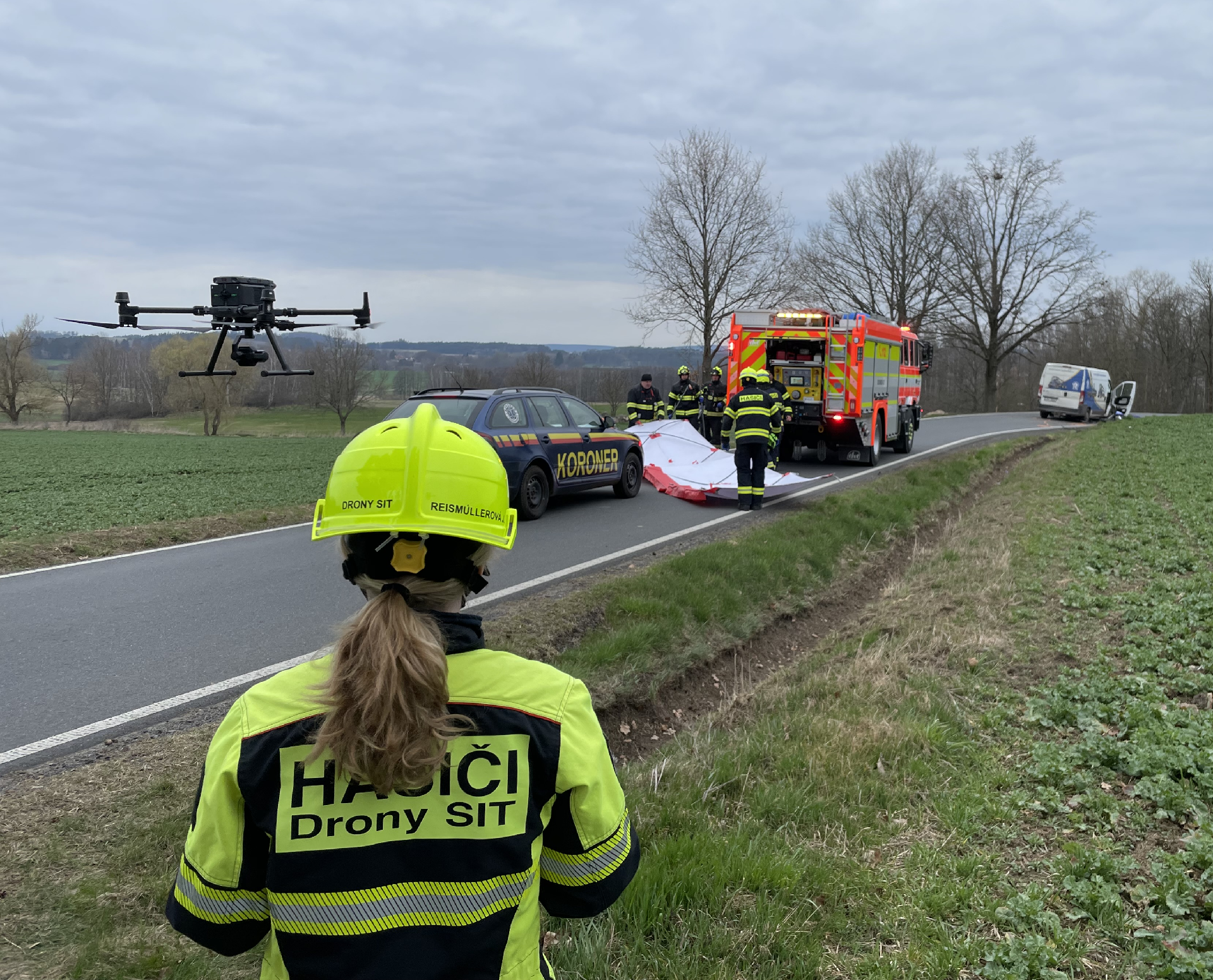
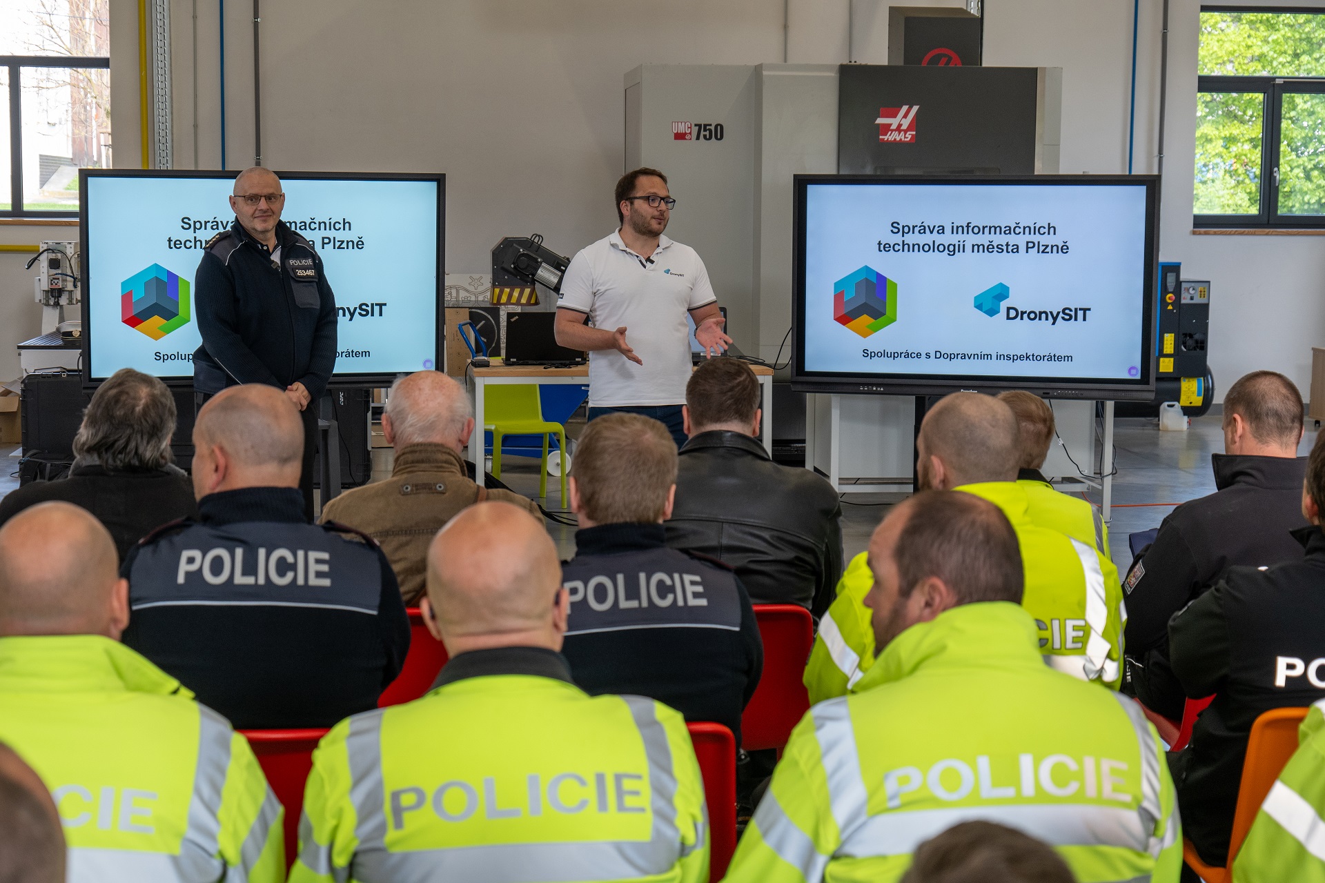
Then in 2018, we were invited to intervene for the first time. It was an air crash when a Robinson helicopter fell on a hall in the city of Pilsen. We were called in to investigate the impact site – to see if the building’s statics had been compromised and it was safe to allow troops into the building. The next intervention was a few weeks later a fire in a hostel in Pilsen. This time it was a search for fire outbreaks for the needs of the IZS.
Current activities of the unit
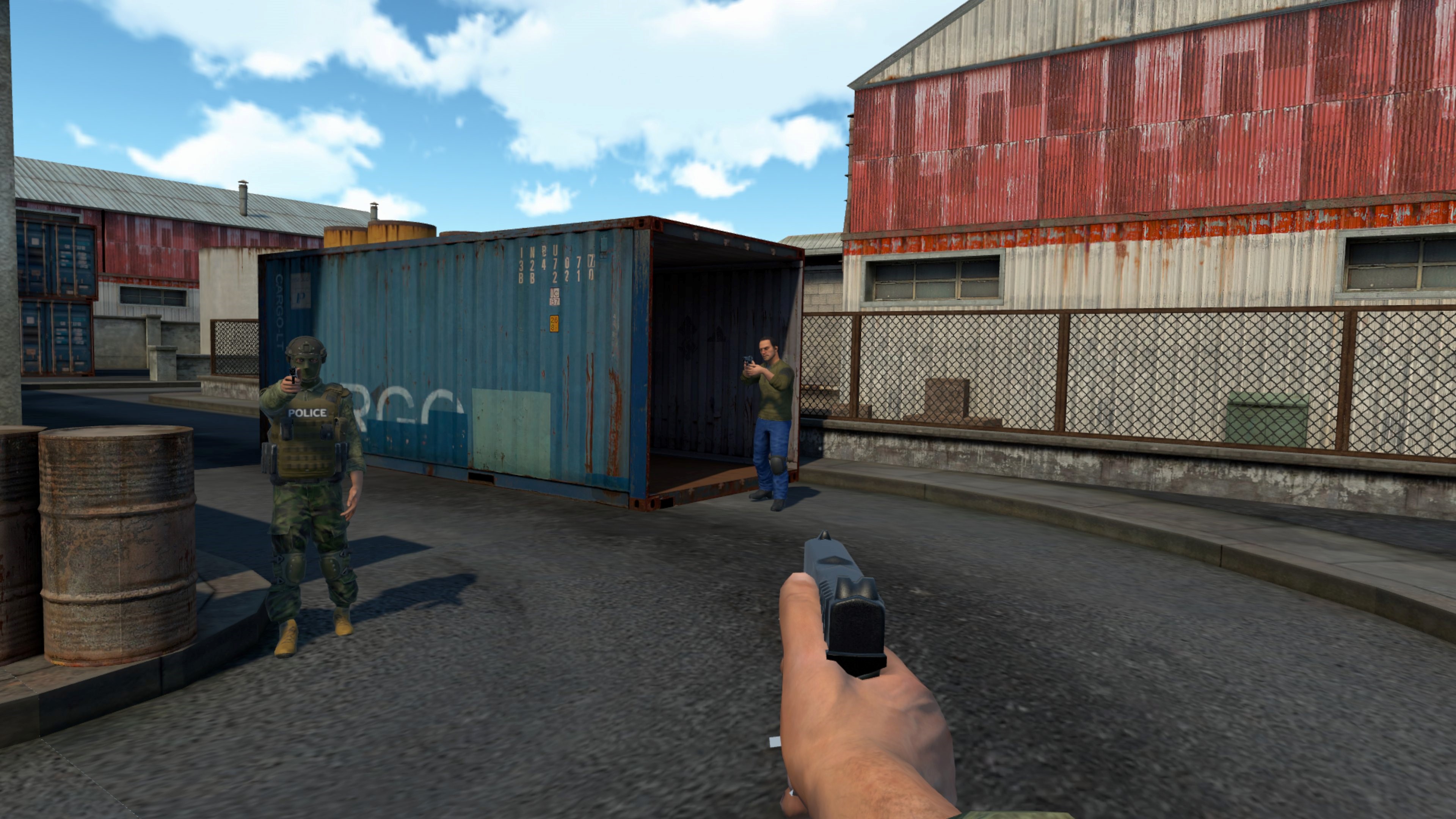
We participate in a wide range of emergencies – we go out to search for missing persons, provide monitoring of large fires, assist in interventions in industrial areas or during floods. The most frequent type of intervention is the monitoring of traffic accidents, thanks to which the police are able to restore the flow of traffic on the road much sooner. Our drones, equipped with thermal cameras and other sensors, provide key data in real time, thus significantly speeding up the decision-making of intervention commanders.
We’re not just drone pilots and technicians – we actively develop our own software to meet the exact needs of emergency responders. We focus on:
- Secure, real-time data and video streaming from multiple devices directly to headquarters and units in the field
- Collection and analysis of sensory data from the scene
- Creation of detailed orthophotos, overview maps and situational reports including 3D point cloud or mesh models
Thanks to our own software, we have full control over the functionality and safety of the systems, which allows us to respond flexibly to new situations and the requirements of the individual IZS units.
At the same time, as a municipal organization, we closely cooperate with the Crisis Management of the City of Pilsen and other municipal departments that take care of security and crisis events in the city of Pilsen.
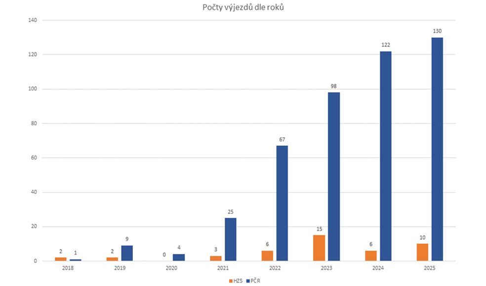
Current number of call-outs
Throughout the year, we respond to various critical incidents, most often traffic accidents. The Czech Police primarily uses our services to quickly restore traffic flow on roads. The second most frequent type of intervention is search and rescue operations. We are able to very effectively replace search parties on open plains, and even searching forests is no longer a problem.
Every year, the number of interventions increases — thanks to our innovations, we are called upon for new types of incidents.
The first chart below shows the number of call-outs by year (blue – police call-outs, orange – fire brigade call-outs).
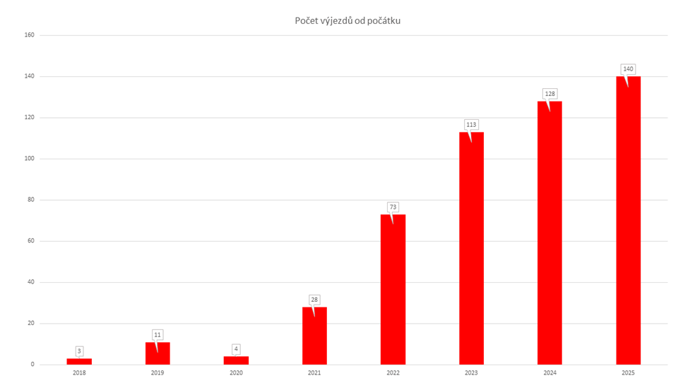
The second chart shows the total number of call-outs by year.
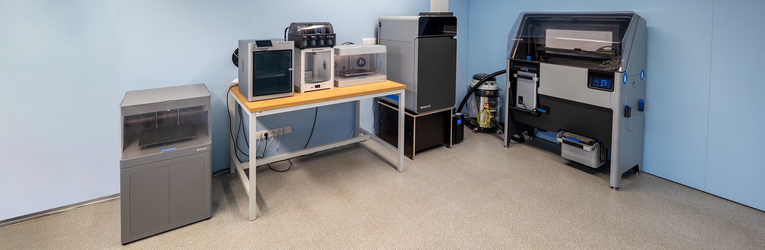
We use 3D printing to develop functional prototypes
In our technical facilities, we use additive manufacturing (3D printing) to quickly develop prototype parts that then help in the field. We create:
- Specific components for firefighting equipment (e.g. brackets, covers or mounting elements)
- Universal components for the medical rescue service and the Police of the Czech Republic
- Products designed based on feedback from real-life interventions
The advantage is the possibility to modify the design very quickly, produce a new version and test it directly in the field. In this way, we ensure that our solutions have real added value for practice. We also create universal solutions for multiple elements so that the firefighter in the field does not have to have special equipment for each technique, but can connect any technical conveniences in different ways and does not have to look at what belongs to what.


Coordination and legislation
Air traffic safety is a top priority for us. We adhere to strict operational standards and carry out all activities in accordance with European and national legislation.
We work with the Civil Aviation Authority (CAA) , Air Navigation Services and other regulators such as airports to ensure we can operate safely even in difficult conditions – in urban environments, near infrastructure or airports. Of course, we also coordinate the flights of multiple unmanned and manned technologies within the intervention. We are also working on a safety staff for flight operations.
Transport Drones Project
One of our key projects is providing full support to emergency services during difficult operations. It is not just about transmitting information from the sky to units in the field, but also about being able to respond to their problems and needs in the best possible way.
That is why we have created the “Transport Drones” project, which enables us to deliver any material with a weight of up to 30 kg to the place of need. This could be, for example, the D-program for the needs of the Fire and Rescue Service, medical supplies, other technical equipment, or even water, which plays a very important role during fires, especially on hot summer days.
AED transport project: when seconds count
One of our key projects is the delivery of automated external defibrillators (AEDs) by drones. The aim is to minimise the time between patient collapse and the initiation of defibrillation. Time is critical in these cases – every minute without assistance reduces the chance of survival by 7-10%.
We propose a network of automated drone stations (nesting stations) that allow to set off with an AED within tens of seconds from receiving an emergency call.


Training Center
Thanks to our regular activities, both in emergency response operations and in tactical and verification exercises, we gain a lot of ideas for improving the entire system.
Our hardware and software specialists then respond to this and create innovations that can assist in this improvement.
These include, for example, gas leak simulators, radiation leak simulators, training tasers, but also the use of virtual and augmented reality with pre-modeled situations that can actually happen in reality.
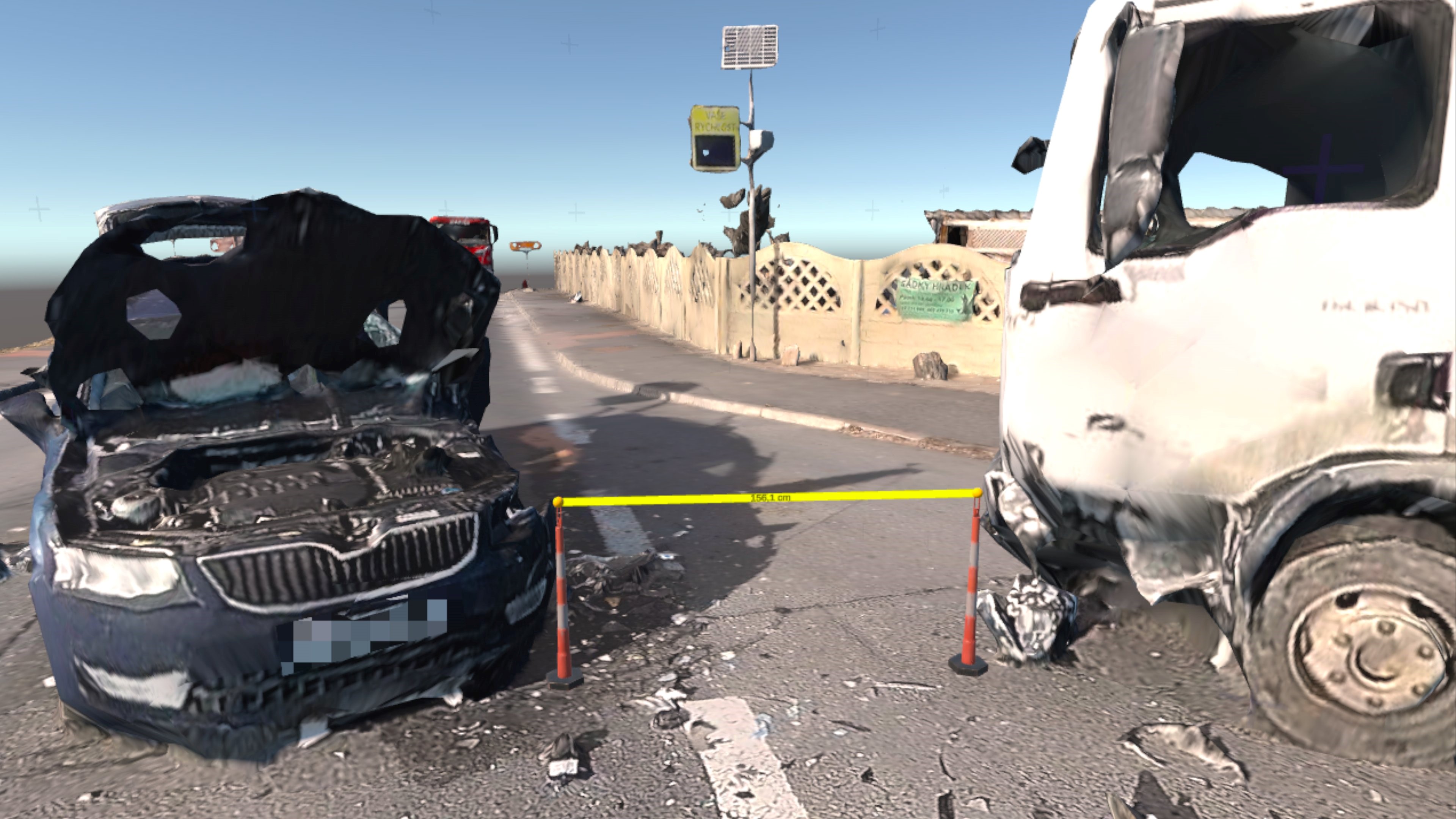
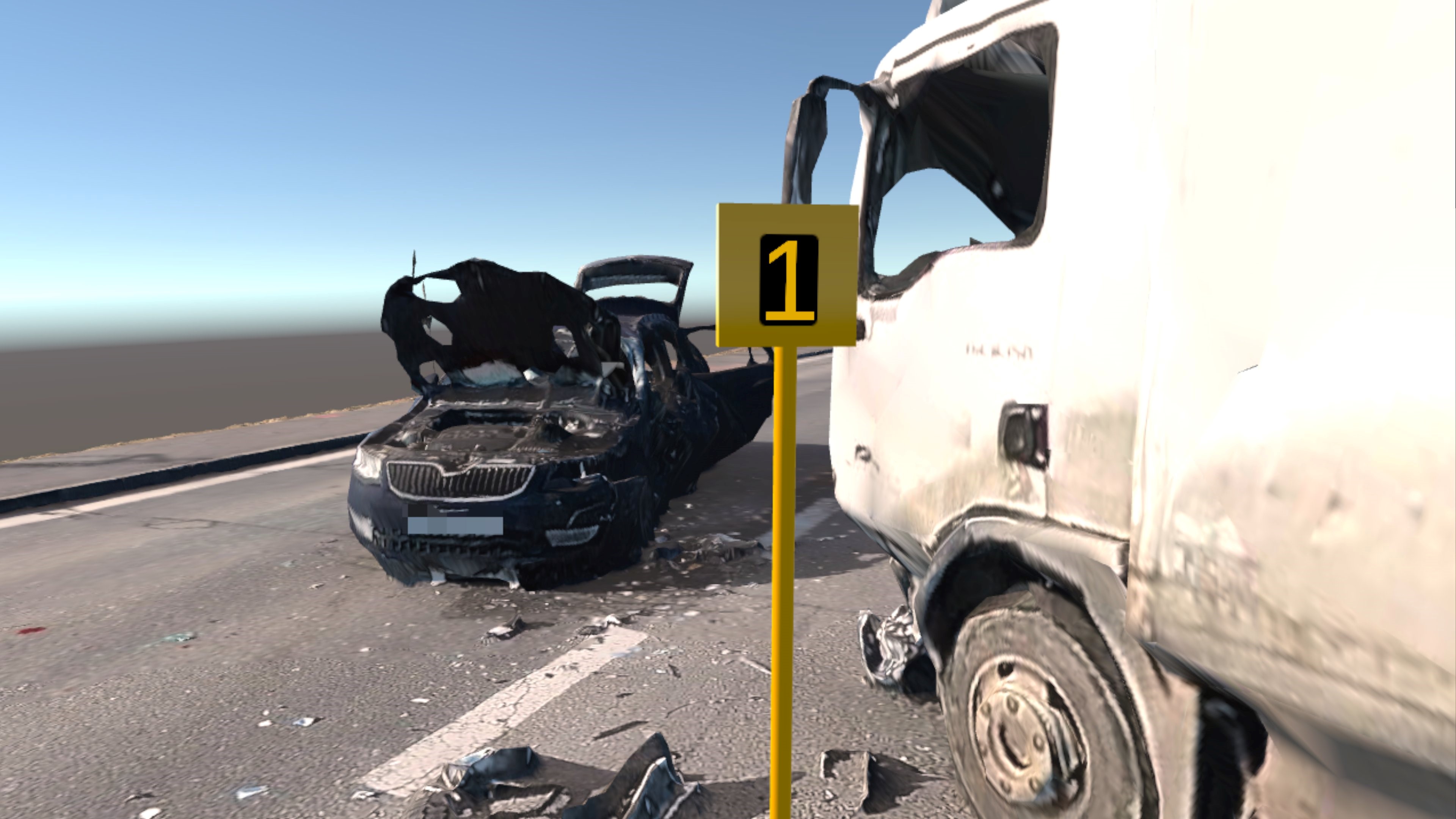
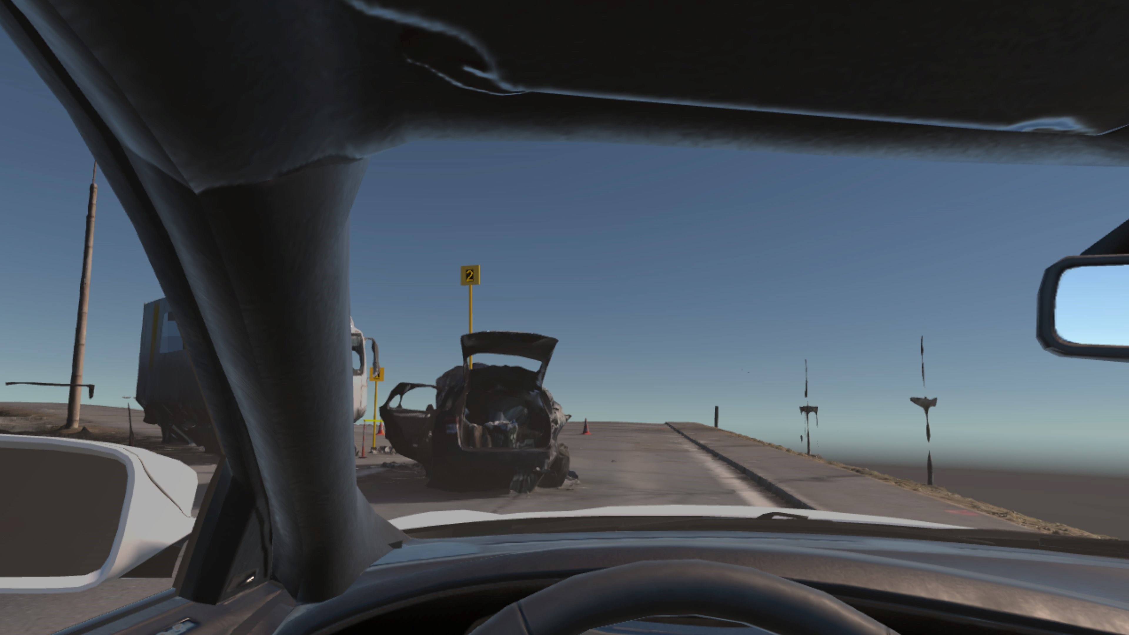
Traffic accidents in VR
The modern technology we use in our operations allows for an immeasurable number of different procedures and outputs in post-processing. One of the outputs of photogrammetric methods can be a 3D model of a traffic accident. We are then able to display these accidents in virtual reality, which also allows for vertical measurements, for example, which are very important. Or, thanks to us, a forensic expert can see from a virtual vehicle what the driver of the real vehicle probably saw.
Our Mission and Purpose
Our goal is to deliver technology solutions that have a real impact on saving lives. We combine research, development, field testing and close collaboration with the emergency services. With proprietary software, hardware, 3D printing and a focus on safety, we create tools that help in crisis and critical moments.
At the same time, we participate in various instructional and methodological sessions, where we show the IZS officers the possibilities of using drones in interventions and the latest available technologies. Alternatively, we carry out demonstrations and training directly at our base. In this way, we try to keep the IZS forces from our region and from other regions up to date and facilitate their work.
We believe that by combining innovation with everyday practice, we can not only make the interventions of the rescue services more efficient, but also safer – for the responders and for those we help.


Drones in use

DJI Matrice 350 RTK
- Extended battery life: The TB60 batteries in the M300 have a lifetime of 200 charge cycles. The TB65 batteries used in the M350, have a lifetime of 400 charge cycles, double that of its predecessor.
- Higher ingress protection rating: The M350 has an IP55 rating and offers better protection from rain and dust compared to the M300's IP45.
- Improved FPV camera: The M350 FPV camera now offers night vision and 1080p image resolution. The predecessor had 960p resolution.
- Arm lock indicator: The arms of both the DJI M300 and M350 must be unfolded and locked before flight. The M350 alerts you to unsecured arms with a warning on the controller, which the M300 cannot.
- New Controller: The M350 comes factory equipped with the DJI RC Plus controller, which has improved ergonomics, a larger screen and extended battery life compared to the M300's Smart Controller.
- More stable and reliable signal transmission: The M350 brings an improved anti-jamming algorithm and uses DJI's O3 Enterprise system and a total of 4 antennas for data transmission. The M300 supports DJI O2 and has two antennas.

Flyability Elios 3

DJI Matrice 4T

DJI Avata 2

Unitree Go2 EDU
Carried equipment

DJI Zenmuse P1

DJI Zenmuse L1

DJI Zenmuse H20T

GL60 Spotlight
Every new contract for us always has the same and only goal - success and a maximally satisfied client.
Contact us